Once an ocean, now a historic landmark
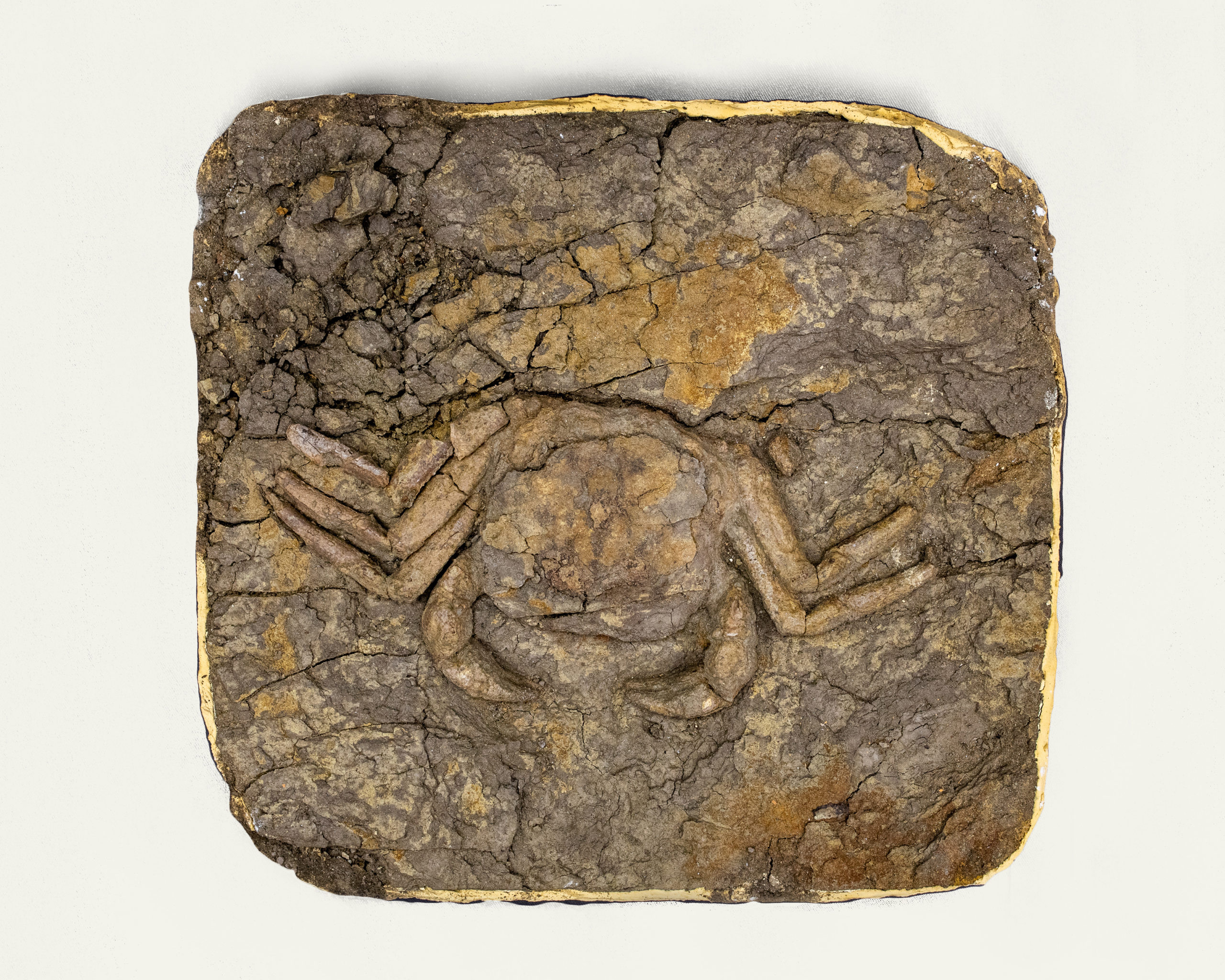
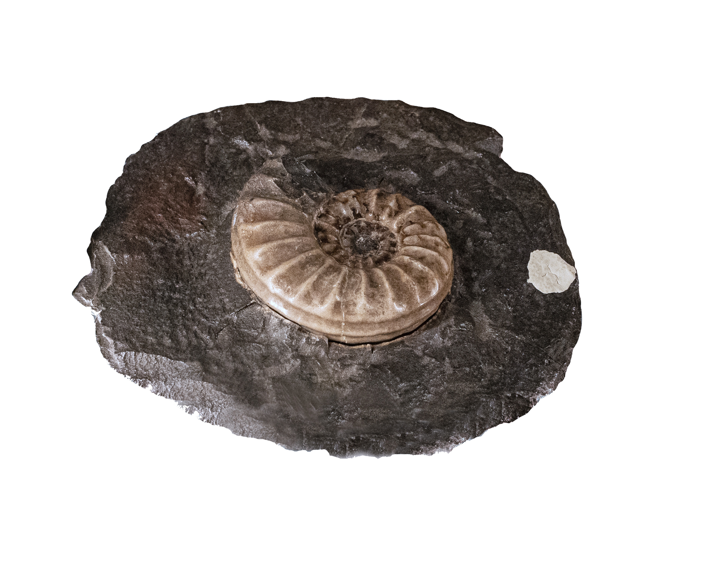
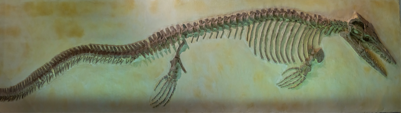
Imagine what is now Memphis being covered by an ocean. Remarkably, some 70 million years ago, virtually the entire Mid-South region was submerged under water. The area was home to giant apex predators such as the mosasaur and other prehistoric creatures. Millions of years later, when the ocean receded, it left behind a historic landmark now known as the Mississippi Embayment.
It took millions of years to create this amazing land Memphis occupies, the Mississippi Embayment, which is one of the largest geographical features in eastern North America. Over an area of 100,000 square miles, through seven states, the Mississippi Embayment dips from southern Illinois to northern Louisiana. It forms a low-lying trough filled with marine sediments to a depth of more than 600 feet. The Mississippi Embayment generally parallels the flood plain of the Mississippi River, and the river, its flood plain and its valley are the Embayment’s most obvious features. Within the Embayment lies a variety of ecological zones including swamps, hardwood forests, meadows, and alluvial plains. Until just over 200 years ago, the largest hardwood forests in eastern North America covered the land from Illinois through Mississippi. A complex indigenous culture, the Mississippian, developed in the Embayment region. The strongest earthquake in historic times was centered in the northern Embayment.
The geography and culture of the Mid-South region is deeply entwined with the history of the Mississippi Embayment. The Mississippi Embayment is a part of a larger physiographic province known as the North American Coastal Plain, which covers the Atlantic coastal region all the way to Texas. During the Cretaceous period (145.5 MYA to 65.5 MYA) the seas reached as far north as southern Illinois. In 2016, Conservation International named the North American Coastal Plain a world ecological hotspot due to dangers in loss of biodiversity. The modern Embayment region lies within three major ecoregions within the Coastal Plain: the Mississippi Alluvial Plain, the Mississippi Loess Plain, and the South Central Plain. Ecoregions are areas where ecosystems, the interrelation between living creatures, soils, minerals, climate and land use, are generally similar and differ from other defined ecoregions.
The Mississippi Alluvial Plain
Alluvial refers to sediments that are waterborne before being deposited. The Mississippi River has meandered through the alluvial plain for 40 million years. Scientists believe there were 24 million acres of floodplains, which supported forests, swamps, and other wetlands as well as the diverse plant and animal life that lived in these environments before humans entered the area. The forests and wetlands were natural flood control structures that held water and protected soils from erosion. Before colonization, the Mississippi Alluvial Plain was the largest forest and wetland ecosystem in North America. Soils were rich and deep, regularly recharged with alluvial soils from the tributaries of the Mississippi River, which drains 2/3 of the contiguous United States during seasonal floods. Indigenous people recognized the rich soils and began to use the Mississippi River Valley for corn agriculture that supported the Mississippian culture.
The Mississippi Valley Loess Plain
The Chickasaw Bluffs, beginning in Lauderdale County, Tennessee, and continuing south to Memphis are part of the Mississippi Valley Loess Plain. Today’s Mississippi Loess Plain is primarily agricultural land originally cleared to grow cotton and tobacco. While cotton is still a major crop in the region, soybeans and corn are also grown here.
The South Central Plains
The South Central Plains ecoregion is located in the farthest southwestern section of the Mississippi Embayment and covers parts of Louisiana, Texas, Arkansas, and Oklahoma. All of these areas were under water during the Cretaceous period. After the final retreat of the Cretaceous inland sea, this area developed hickory and pine forests. After permanent European and then American settlements were established in the region, settlers used the forests for lumber and most of the original forests have disappeared and been replaced by loblolly and short leaf pine.
Aquifers of the Mississippi Embayment
Perhaps the most valuable asset of the Mississippi Embayment lies beneath the surface, as the water supply known as the Mississippi Embayment Aquifer system. Aquifers are areas of sand and rock which hold water. The Mississippi Embayment Aquifer system covers an area of 160,000 square miles of Alabama, Arkansas, Illinois, Kentucky, Louisiana, Mississippi, Missouri, and Tennessee and provides water for drinking and agricultural use.
In 1886, drillers for the Bohlen-Huse Machine and Lake Ice Company discovered the aquifer in Memphis, Tennessee. The first aquifer tapped was around 200 feet deep, today known as the upper Claiborne aquifer. The middle Claiborne aquifer is thickest in the Memphis area, and it holds an astounding 50 trillion gallons at any given time. The age of the water pumped from this aquifer is generally 2,000-3,000 years old.
The middle Claiborne aquifer is capped with a clay layer deposited by an inundation of the sea, keeping the water pristine and filtered through the sand and rocks. However, many wells, building projects, and natural collapses have punched holes through the clay, allowing water from shallower aquifers and even shallow groundwater to penetrate. These waters are often contaminated with industrial and agricultural runoff that must be closely monitored. In one area in Shelby County, a landfill is slowly leaking toward some of the wells. If the chemicals from these sources of pollution make it to a well, costly filtration will have to be added to what is otherwise one of the cleanest water supplies in the United States.